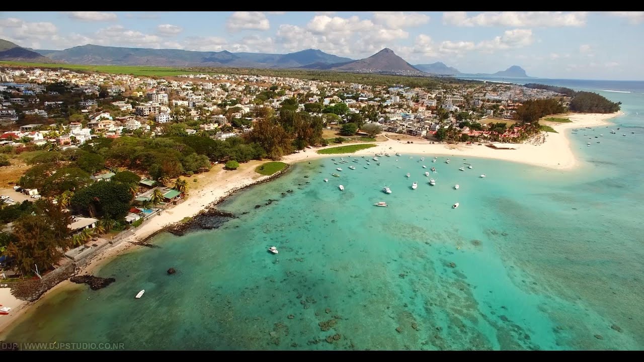
Curepipe Curepipe is by far one of the most densely populated areas within Central Mauritius, and...
Curepipe Curepipe is by far one of the most densely populated areas within Central Mauritius, and...
Features information that is relevant to travellers who are thinking about and actively planning a visit to Mauritus.

Le Pouce is the third highest mountain in Mauritius, at 812 meters. It is named Le Pouce because of the thumb-shaped peak of the mountain. It can be viewed from the capital of Mauritius, Port Louis, and is a popular hike for the view of the city. The mountain is in the moka range and is closest to the village of La Laura-Malenga in the moka District. charles darwin ascended the mountain on 2 May 1836.
Le Pouce was formed ten million years ago from volcano eruptions.It has the capital city of Port Louis on one side and St. Pierre on the other. Le Pouce Mountain will offer you a splendid panorama of Le Morne, coin de mire, the capital city, and other sites on the island. It is nestled between montagne des signaux and Pieter Both mountain.
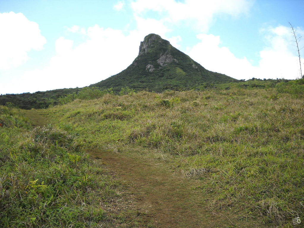
The trek to the top of Le Pouce is considered an easy hike. But the ascent is very steep, especially near the thumb. Le Pouce can be reached from Moka or Port Louis. Climbing gear is not needed. From the peak one can see Port Louis, Moka, and Beau-Bassin Rose-Hill, as well as many other places around the island.
During your hike to the summit you can explore the flora-covered mountain, and discover exotic plants as well as some rare and unique endemic species.
When you reach the first plateau you can choose to continue on the left and down to Port Louis or the right towards the top of the mountain. Higher up you will find a second plateau, an esplanade, where you can relax and enjoy the view before continuing to the top. The final ascent is steeper and requires some dexterity and fitness.
The start of the trail for hiking Le Pouce is located in petit verger near the village of Saint Pierre in the Moka region.There is no sign post at the starting point of the trail. You can locate it with the help of the map or directions from the locals. There is a small car park with enough room to fit four to five cars.
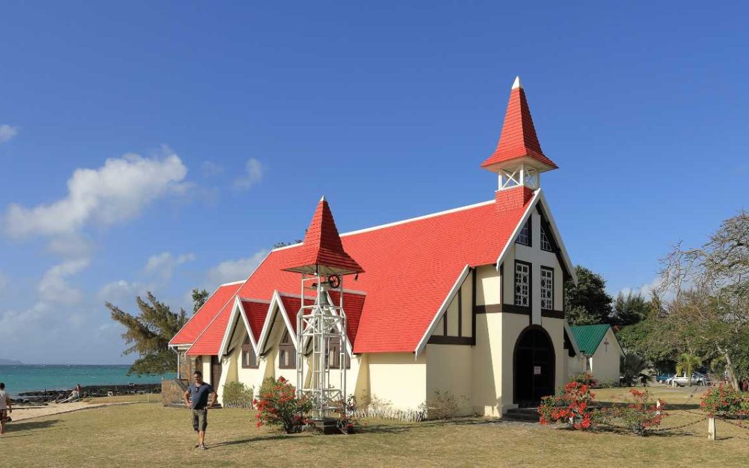
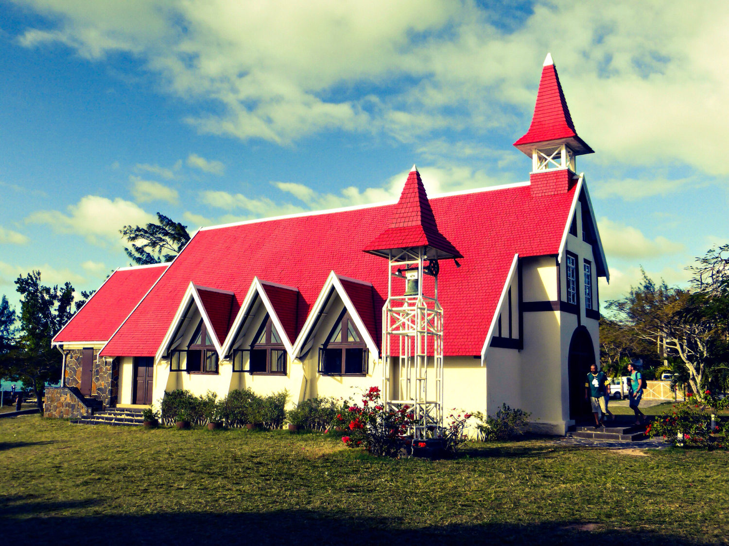
Situated in a small fishing village of Cap Malheureux, the Notre Dame Auxiliatrice is one of the oldest churches that stood witness to one of the most written-about wars between the French and the British over the control of the island.
“Cap Malheureux”, translates to “Unfortunate/Unhappy Cape”, due to the numerous ships which floundered there in the past. The church was built as a commemorative landmark to the shipwrecks that happened. It is also known by the name “the red roof chapel” and is renowned for its aesthetic value as well as historical significance. The church boasts intricate woodwork and a holy-water basin fashioned out of a giant clamshell. With a bright red roof, the church is one of a kind and a picture-perfect postcard-worthy attraction in Mauritius.
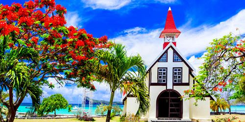
This simple chapel was founded in 1938 and is dedicated to the Virgin Mary. It is situated ideally at the very northern point of Mauritius, offering breathtaking views of the five northern islets, including Coin de Mire (Gunner’s Quoin).
This Church draws in as many tourists as worshippers. On Sunday mornings, many tourists can be found joining the mass. Surrounding area is a popular spot for newlyweds to have their pictures taken. A sign strictly prohibits newlyweds ‘faking’ a church wedding for the photographers here, but newlyweds, genuine or otherwise, with their photographers are a common sight in the church grounds.
There is a pretty little beach right behind its main building.The church also boasts a wonderful choir that’s well known in the country.
Some believe the church was named after the sinking of the vessel Saint Geran on 18 August 1744, which inspired Bernardin de St Pierre to write his famous novel “Paul and Virginie”. While others believe it owes its name to the numerous shipwrecks that occurred in this area at the beginning of the colonization of the island.
It is also the landing point of the British onto the island in 1810, to attack the French. The French who occupied the island then, named it the Cape of Misfortune after the British surprised them by attacking the north of the island instead of the island’s harbour in Mahébourg and took possession of the island.
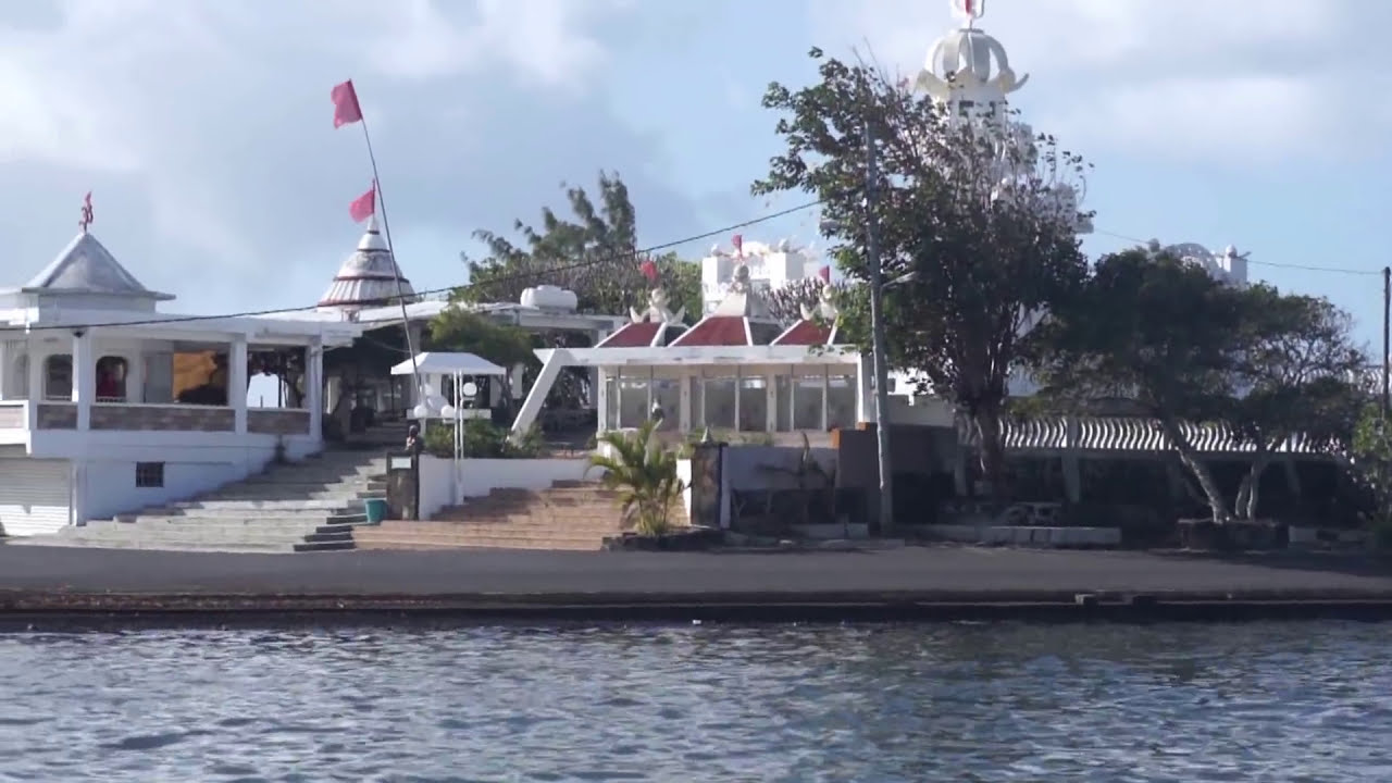
The area also houses a marine cemetery and a Hindu temple.
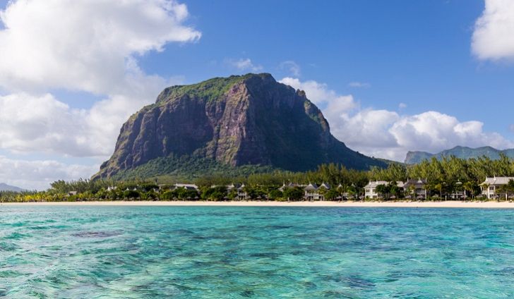
Le Morne Brabant is a peninsula at the extreme southwestern tip of the Indian Ocean island of Mauritius on the western side of the island. Le Morne is a site of an extent of 480 hectares comprising private properties, State Land and mountain reserves.
There is an eponymous basaltic monolith with a summit 556 metres above sea level. This summit covers an area of over 30 acres.
In 2008, UNESCO inscribed the site on the World Heritage List.
Le Morne was used as a shelter by runaway slaves, maroons, through the 18th and early years of the 19th centuries. The slaves came from the African mainland, Madagascar, India, and South-east Asia.The escaped slaves formed small settlements in the caves and on the summit of Le Morne protected by the mountain’s wooded and almost inaccessible cliffs. The oral traditions have made Le Morne a symbol of the slaves’ fight for freedom, their suffering, and their sacrifice. Le Morne came to be known as the “Maroon republic” because of the large number of escaped slaves who lived on Le Morne Mountain.
The punishment for escaping from slavery was very harsh and it included whipping, torture and even death until the British passed the Slavery Abolition Act in 1834.
Nature lovers should try Le Morne Brabant’s impressive 3.5 kms hiking trail for having a more immersive experience in the area’s exoticism. You will walk through luxuriant green vegetation consisting of gigantic endemic trees as well as smaller exotic plants. The hike can last between three to four hours, where you will be guided by professionals. As you hike your way to the top, you will find a gigantic, basalt rock peak dotted with caves which once harbored runaway slaves.
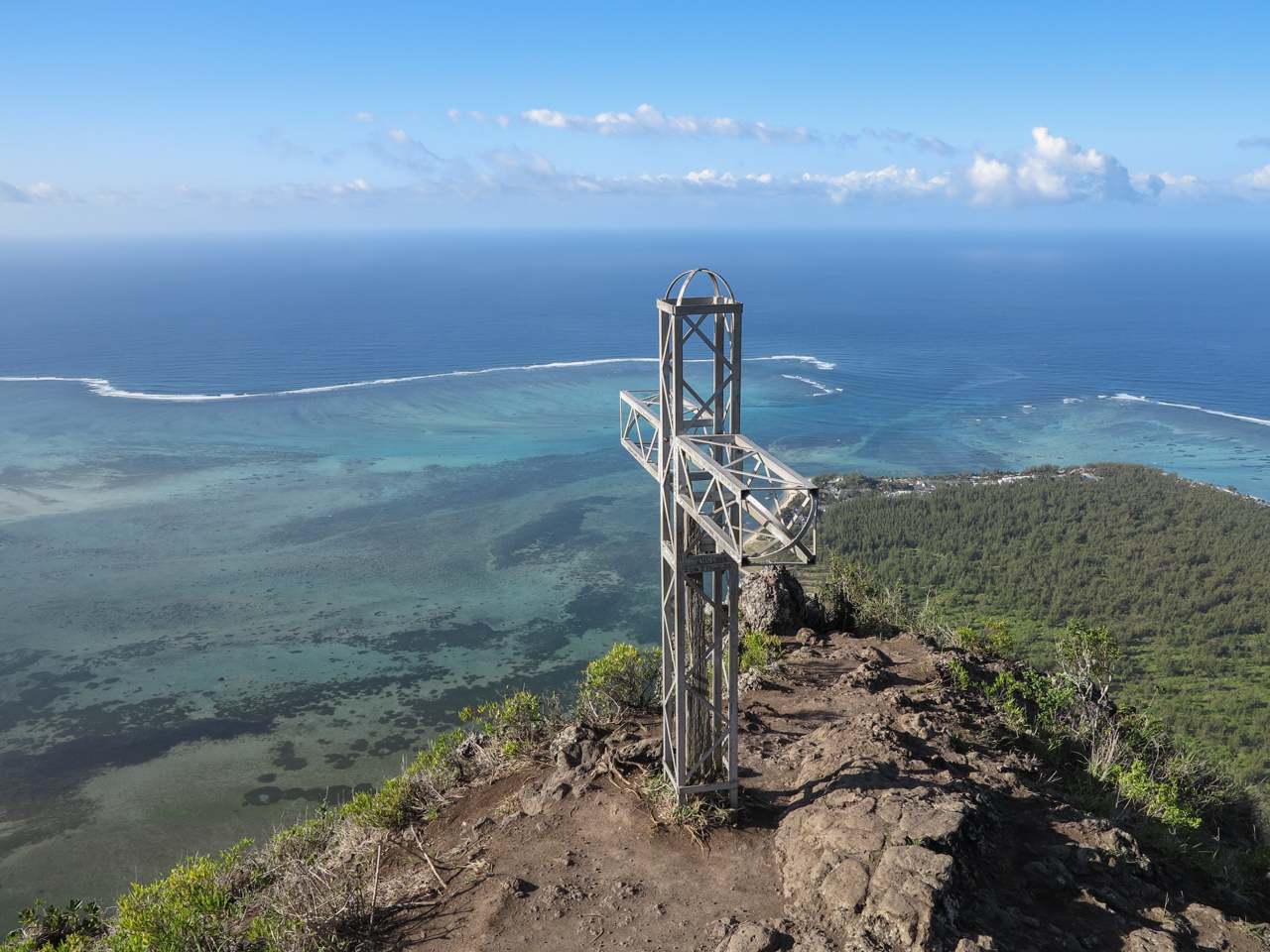
At the top there is a huge metal cross which marks the highest accessible point. From there you will get a truly breathtaking view over the Indian Ocean and Mauritius’ beautiful southern region.
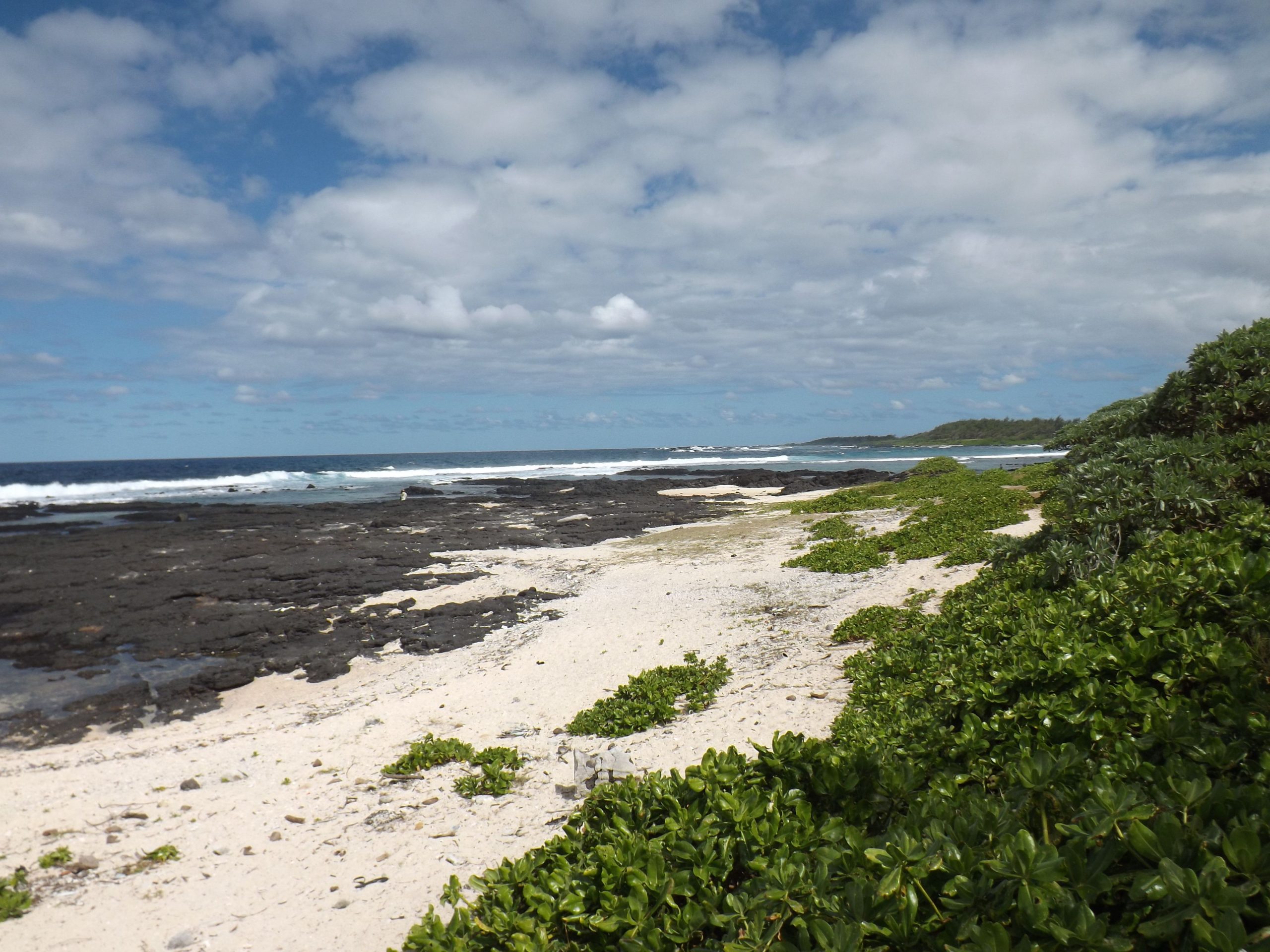
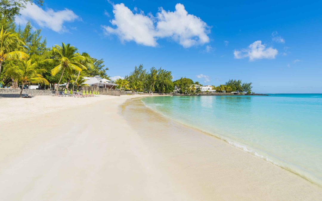
The beach of La Cambuse is a beautiful beach in the southeast coast of Mauritius. The white sandy beach is surrounded by greenery along the turquoise sea. The sea is generally rough with strong currents and therefore swimming is not recommended. However if you want to swim go to the right end of the beach and you will find an area where the water is surrounded by rocks that seems fit for a swim.
The best time to visit the beach of La Cambuse is early in the morning from 9:00 to 11:00 or in the afternoon from 13:00 to 16:00. It is within a couple of miles from the SRR International Airport. The beach is not crowded because it is not very frequently visited by the local people or even by the travellers and you can enjoy a peaceful vacation there. Mountain biking or standard electric biking is perfect for La Cambuse as it enables one to take the small paths that are otherwise inaccessible.
Blue Bay Beach Apartment has two large bedrooms with attached bathrooms.
Le Jardin De Frangipane has only one bedroom and a bathroom. The bedroom is small and can accommodate only 2 people.
Villa Bella has one luxurious bedroom with an attached bath which can accommodate only 2 persons.
Studio LE FILAOS is a quiet place with self catering facilities such as kitchen, refrigerator and electrical appliances. The bungalow is fully air-conditioned. The room has two single beds and an attached bathroom.
Shona Apartments is luxurious with three large bedrooms, a fully equipped kitchen and also a large living room.
Pereybere is located in the district of Riviere du Rempart on the north coast of Mauritius. It is around 30mins drive from the capital Port Louis. From the airport, the drive takes around 1 hour and 30 mins to reach Pereybere.
Pereybere is one of the most popular beaches of Grand Bay. There are a variety of water sports, a translucent turquoise sea and white sandy beach. It is a small creek which is very popular among tourists and locals who attend in large numbers during the week and especially on weekends. The beach is suitable for family swimming, and is ideal for children and inexperienced swimmers. Near the beach vendors sell exotic fruits and ice cream. Nearby restaurants offer varied menus.The best time to visit the beach of Pereybere is early in the morning from 9:00 to 12:00 or in the afternoon from 14:00 to 17:00.
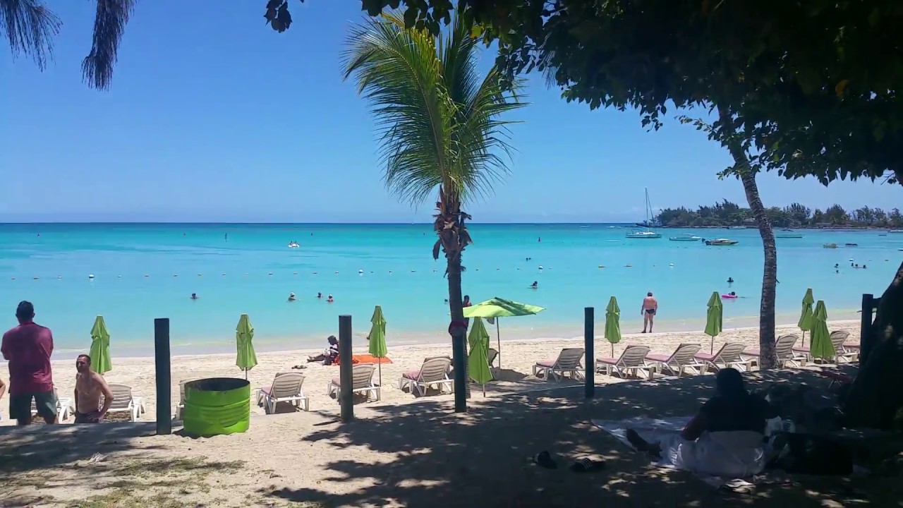
Activities at Pereybere include pedalo, windsurfing, catamaran, parasailing, scuba diving, deep sea fishing and kayaking.
In Pereybere there are excellent boutique hotels and self-catering villas,apartments, holiday rentals and two to five-star hotels. Hotels in Pereybere are Ocean V Hotel, Hibiscus Beach Resort & Spa, Pereybere Hotel & Spa, Casa Florida Hotel and Spa, Pereybere Serviced Suites, Villa Pointe Azur, Merville Beach Hotel, Nitzana Residences & Restaurant, Miramar Villas, and Hacienda Plaza.
Other famous beaches you can visit from Pereybere are Bain Boeuf, La Cuvette, Grand Baie, Mont Choisy and Trou aux Biches.
Attractions to visit nearby Pereybere are Cap Malheureux Church, Galerie du Moulin Cassé Art Gallery, L’Aventure du Sucre (a former sugar factory), Sir Seewoosagur Ramgoolam Botanical Garden, and The Château de Labourdonnais (another old sugar factory).
Pereybere is located halfway between Grand Baie and Cap Malheureux and it is possible to reach one town or the other in a few minutes. The village is only 5 kilometers from Mont Choisy with one of the most beautiful beaches in Mauritius.
Pereybere has a good bus route leading to key locations in Mauritius. You can easily get the bus to Port Louis or to other cities such as Triolet, Goodlands and Grand Gaube.
Flacq is a district of Mauritius, situated in the east of the island. It is the largest district, having an area of 297.9 km².
Trou d’Eau Douce is a small village in this district, from where visitors take boats for tours on Île aux Cerfs island. Belle Mare is an important beach which attracts a lot of Mauritians and tourists. All kinds of water sports are available here.
Activities
Several cruises and tour trips are available from Poste de Flacq. In The downtown area there are museums, boutiques and excellent restaurants that serve Creole dishes as well as international cuisine. There are markets that offer juicy fruits, fresh farm vegetables to an array of handmade Mauritian products. You can rent a car and explore some fifteen cities and towns past the border.
Flic-en-Flac is a seaside village on the west coast of Mauritius in the district of Black River. The name most likely comes from an Old Dutch phrase, “Fried Landt Flaak”, meaning free, flat land.
Flic-en-Flac is in a non-industrial part of Mauritius, with a coastline of about 13 kilometres. There are many luxury hotels, resorts, rental apartments, restaurants, bars, clubs and souvenir shops in this area. which attract about 500,000 tourists a year. Flic-en-Flac is lively both during day and night.
Weekend Activities
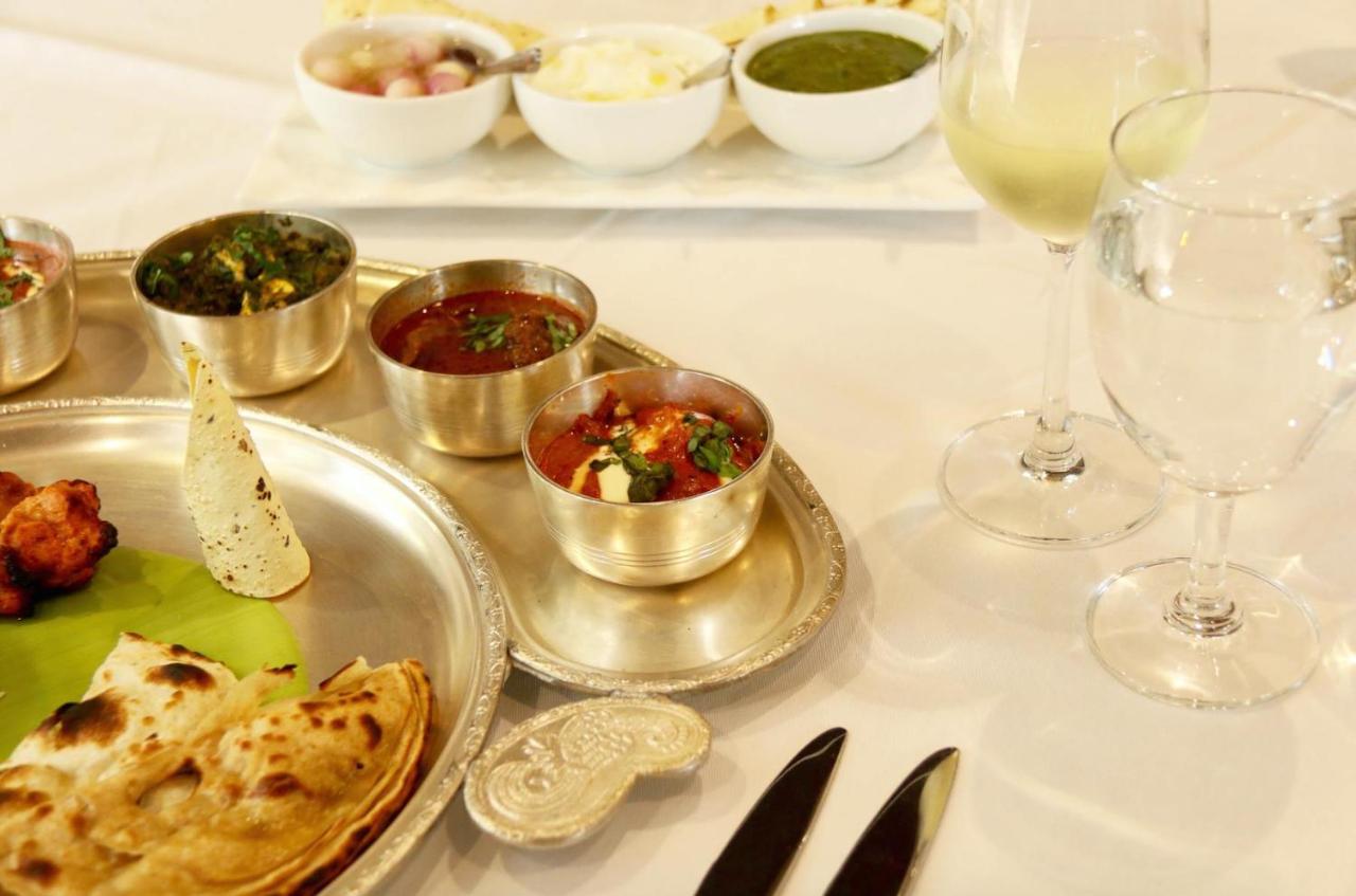
On the weekend, a lot of locals go to the beach to spend the day with their families and friends. Some of them will engage in water sports like swimming, snorkelling, diving etc. Some of them will sing and dance to the typical Sega music. They also enjoy delicious street food such as DhalPuri and fried noodles with Mauritian meatballs. DhalPuri is multi layered thin flat bread with some flavorful curry and sauces wrapped in.
Night Life
The nightlife is very vibrant as a lot of locals and tourists go out to the nightclubs and restaurants to enjoy the night and meet people.
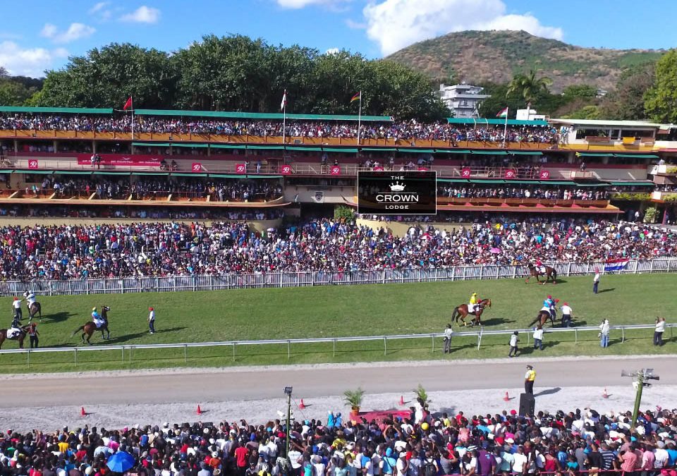
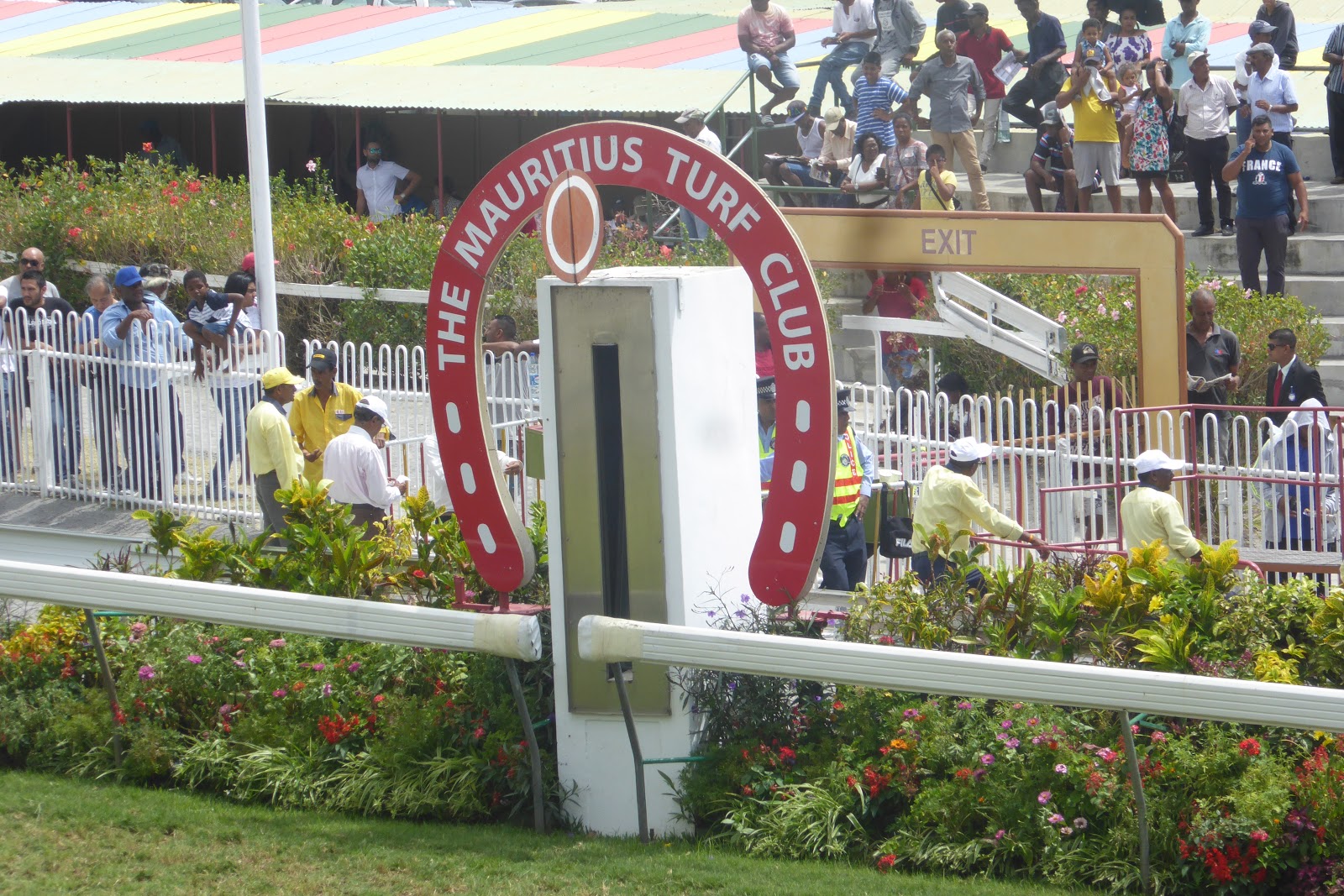
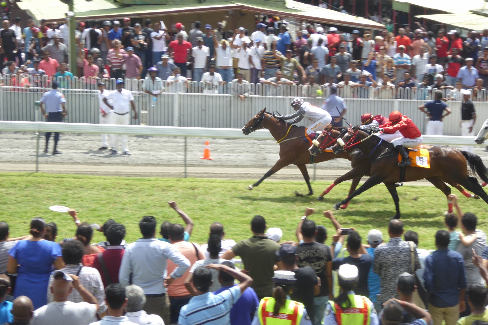
Champ de Mars is one of the oldest racecourses in the world. It became operational on 25 June 1812 with the support of the then governor of the island, Sir Robert Farquhar. He introduced horse racing in Mauritius to win the esteem and the collaboration of the French population. Now the racecourse is managed by the Mauritius Turf Club.
Horse Racing constitutes one of the most popular sports in Mauritius. It attracts more than 20 000 persons at Champ de Mars every week. Instead of the more common races, the four classics are preferred: the Duchess of York Cup, the Barbé Cup, the Duke of York Cup and especially the Maiden Cup, which takes place exceptionally on a Sunday (and not a Saturday) in September. This last event is the most popular. The horses are specially prepared for this one and run two laps each time, a distance of 2,400 metres. On this day, the lawn is full and the crowd can reach over 100,000 spectators.
The Crown Lodge is a hotel attached to the racecourse. Jacques Ritter, a former rider, owns Crown Lodge. It was launched in May 2002. It is a private steward suite converted to allow tourists from around the world to discover, in optimum conditions of comfort and safety, the electric atmosphere of horse racing in Mauritius. The Lodge is located on the VIP balcony, next door to the office of the president of the Mauritius Turf Club. It offers a magnificent view on the finish line and the paddock. A variety of drinks (alcoholic and non-alcoholic) and local snacks are offered throughout the day. You will also have the opportunity to meet the trainers and horse owners.